06/11/17
While thinking about an image to use for Exercise 5.2 (homage) I went back over several of the exhibitions I had visited recently. When looking at the images, one by Sirkka-Liisa Konttinen from the Coal Coast series struck me and I remembered that there is some unusual debris on part of the coast in Fife near Torryburn. Oddly enough, there is the usual beach flotsam and jetsam but there is also a stretch of about 200 metres of coast that is strewn with old bricks and sanitary-ware (broken up large pieces of ceramic sinks). The local mythology – which I haven’t been able to confirm – is that it comes from the destroyed wash-houses of one of the local pits, and was put on the beach at that point to stop erosion. There is no logic to why the erosion should be particularly bad just there, and I suspect the truth is that it was just dumped, although that is odd in itself, as there is no road nearby and the shore is very gradually shelving for at least a hundred metres, so you couldn’t get a boat large enough to bring the rubble in close enough.
I felt that there was a possibility of doing my homage shot on the beach as there are several possible links with the image I was thinking of, so I went back over both the exhibition images as a whole and re-thought about it and the accompanying film which I have discussed in more detail in the blog post below.
https://wordpress.com/post/scottishzoe.blog/2478
Coal mining in Fife has a long tradition, with coal having been dug since the thirteenth century and the Fife coalfields were the largest in Scotland. Many ran under the Forth and were very deep. The nearest pit to this stretch of coast would have been the Valleyfield pit which closed in 1978. There is little surface evidence left of this extensive underground industry except the occasional pit-head and the endless bings (spoil heaps). The last deep coal mine at Longannet, which stretched well under the Firth of Forth was closed in 2002 after flooding. There continue to be ongoing attempts at open-cast mining, which scar the countryside and cause aggressive debate.
I have been to this beach on many occasions, and also to the pit-head further along the coast at the Seafield Colliery however have never taken any images of the debris, so I went back this weekend at high tide, and again at low tide to look at the area and the surrounding coast.
Setting the scene:


The chimney in the distance is part of Longannet power station, which is now disused. At low tide the mud flats stretch out for about a hundred metres, although I would not advise walking on them, as the tide can come in extremely fast, and much of it forms quicksand.
The surrounding flora (winter variants):


There is a wide variety of wildflowers and bushes along the edge of the coast here and they attract thousands of birds, many of which are protected species.
The bricks:


Part of the rubble is made up of bricks that come from the local brickworks and are stamped with the source name: Lochgelly, Bowhill, Hill of Beath, Lochside. More evidence of an industrial past now gone.
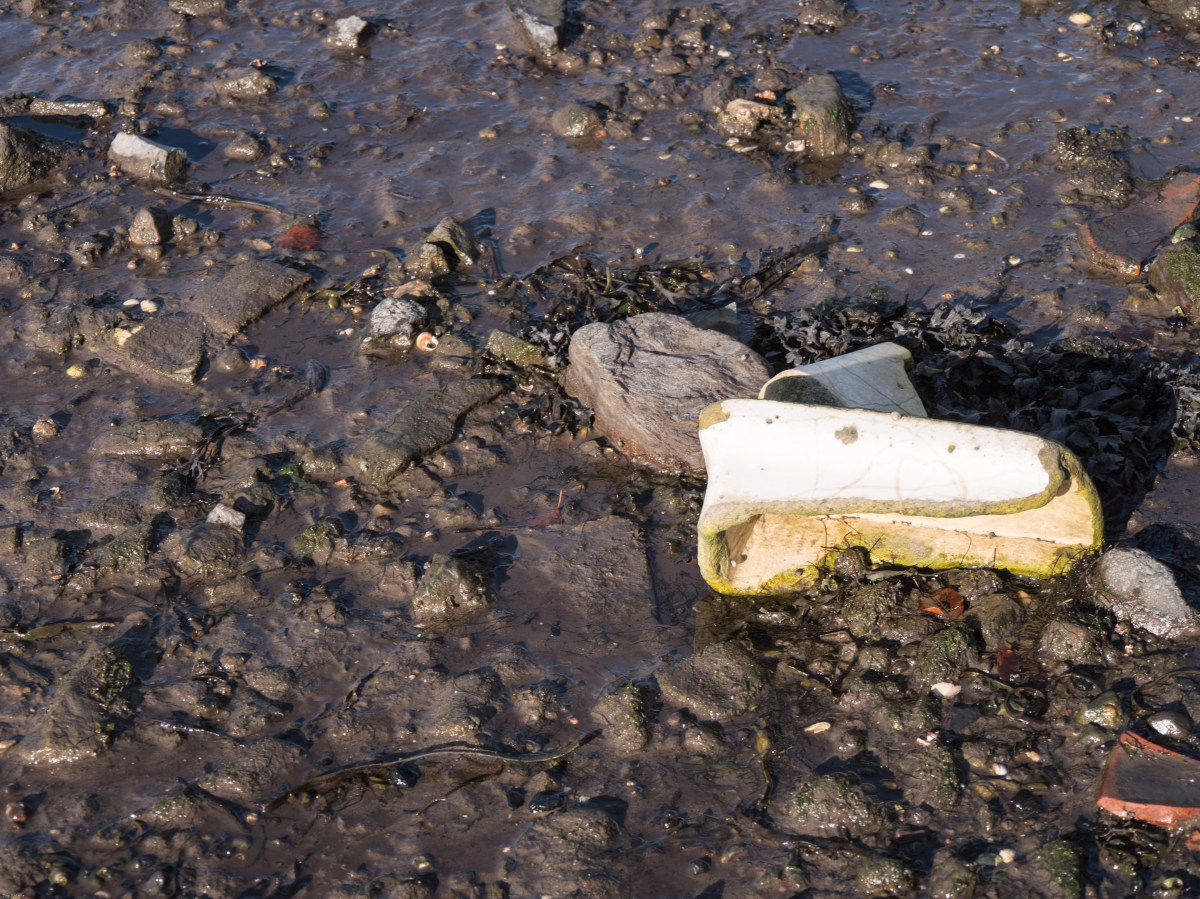
The evidence:


It remains a mystery as to how the sanitary-ware reached this spot – and why in such a localised and inaccessible (except by foot) point.
